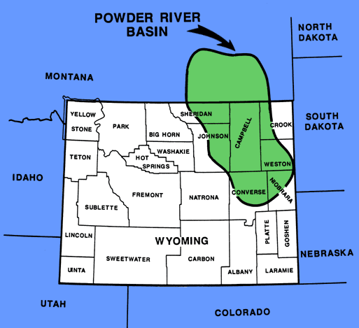
Area of Coverage
A total of 5,587 Minnelusa wells are available in the database and ready for immediate delivery. The entire database is composed of 49 townships. All wells within this area that penetrated the Minnelusa formation and had logs were digitized. Most of these townships were digitized in the late '80s and early '90s. Use the form below to check the availability of wells in your area-of-interest. We will work with you to update wells that were drilled in your area-of-interest subsequent to our digitizing that township.
|
|
|||||||||||||||||||||||||||||||||||||||||||||||||||||||||||||||||||||||||||||||||
Note: if you require data on wells outside this area of coverage, please contact us info@minnelusa.com to discuss your digital well log data needs.